
Mapping/GIS Data
Welcome to our award winning GIS department. We recently were awarded the Geospatial Technology Applications Special Achievement Award from the WVAGP for our advancements in online GIS mapping of Kanawha County.
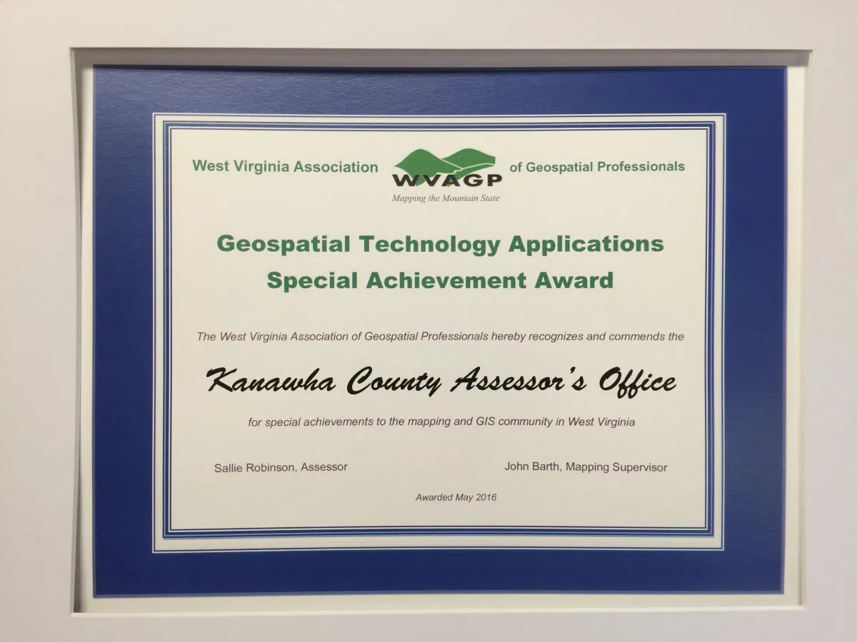
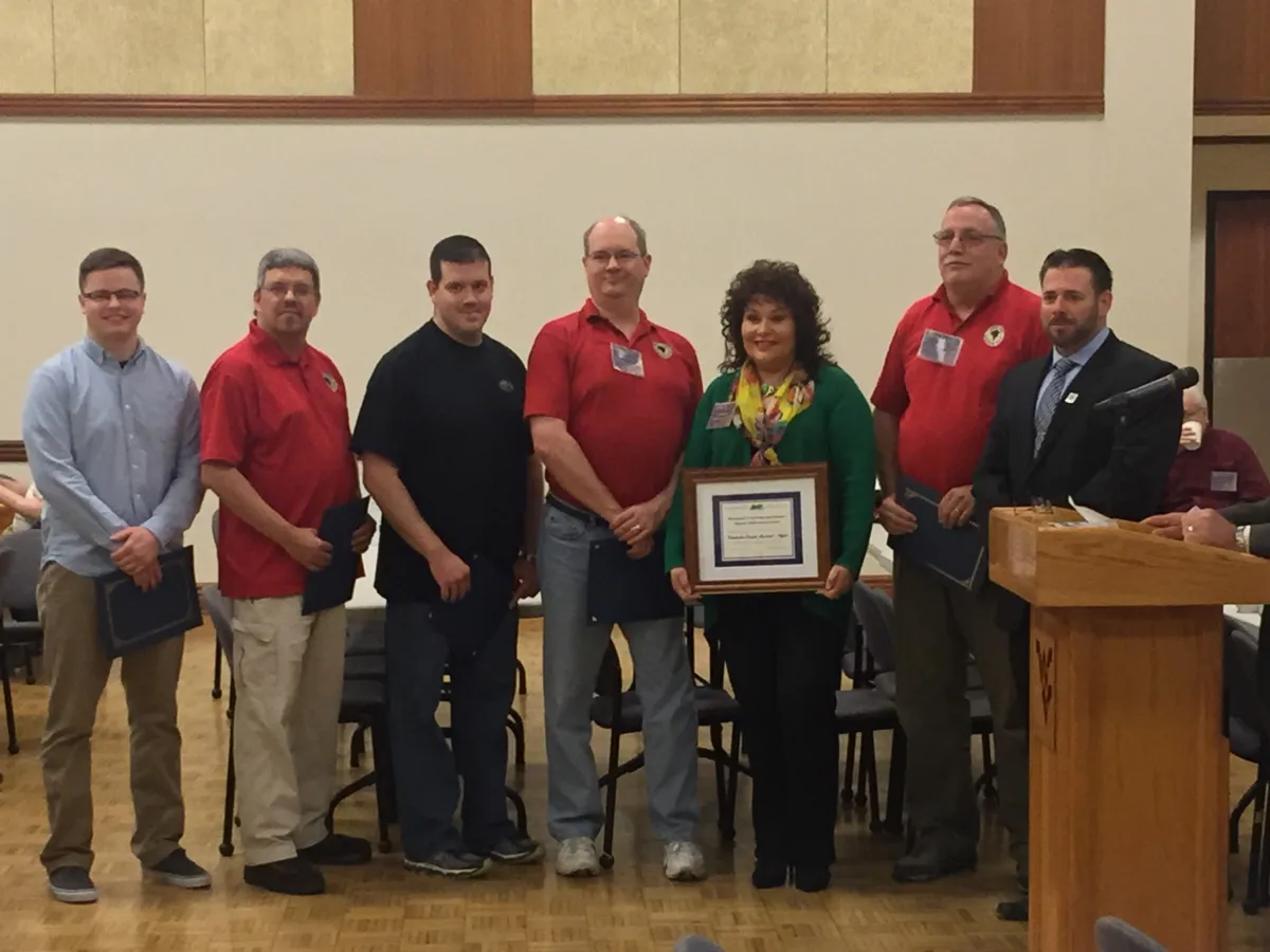
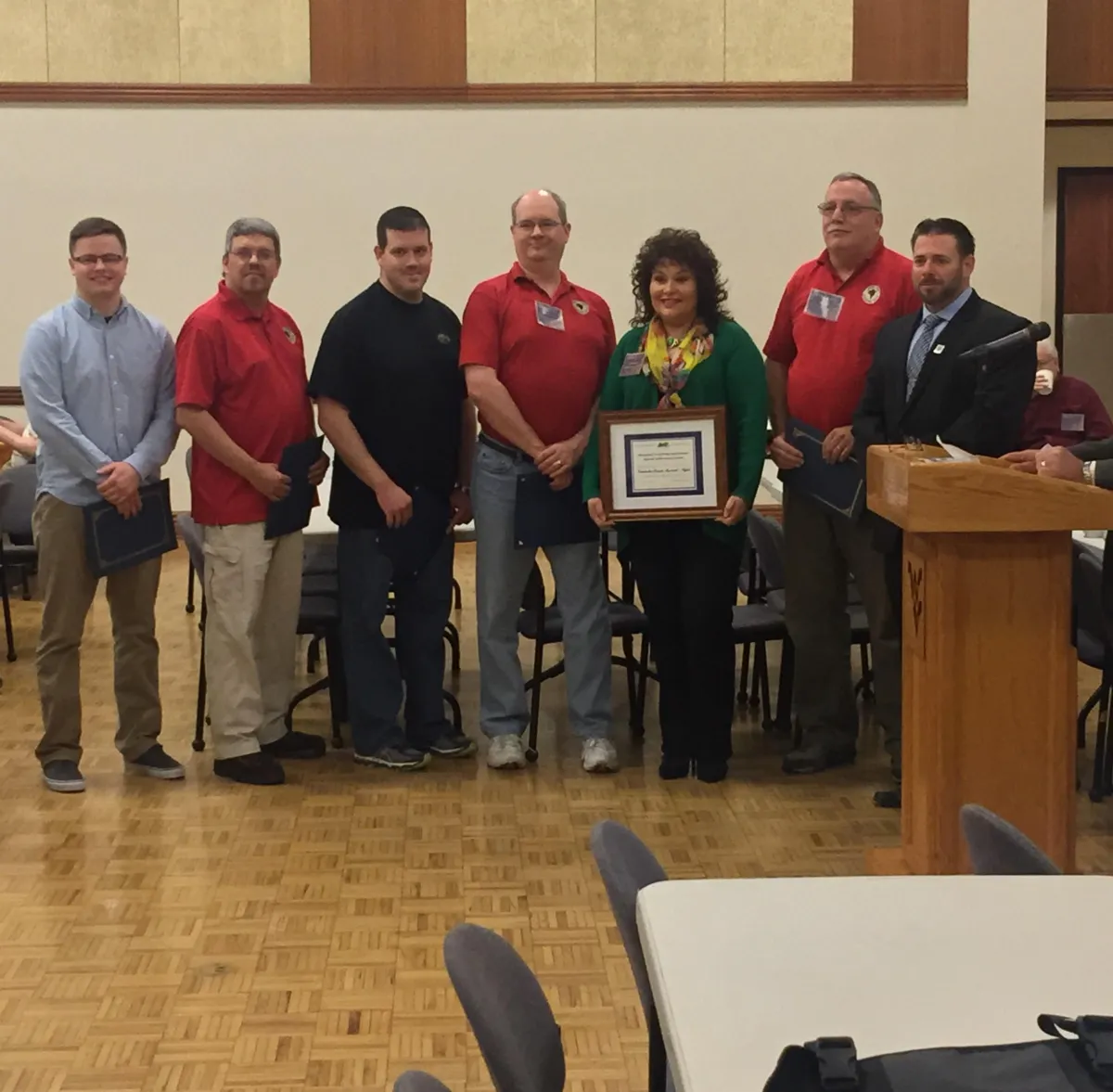
Special thanks to Chris Chrzanowski (GIS Coordinator) and John Barth (Mapping Supervisor) for heading up the project and to Randy Campbell, Kenneth Weese, and Josh Summers for their assistance in the process.
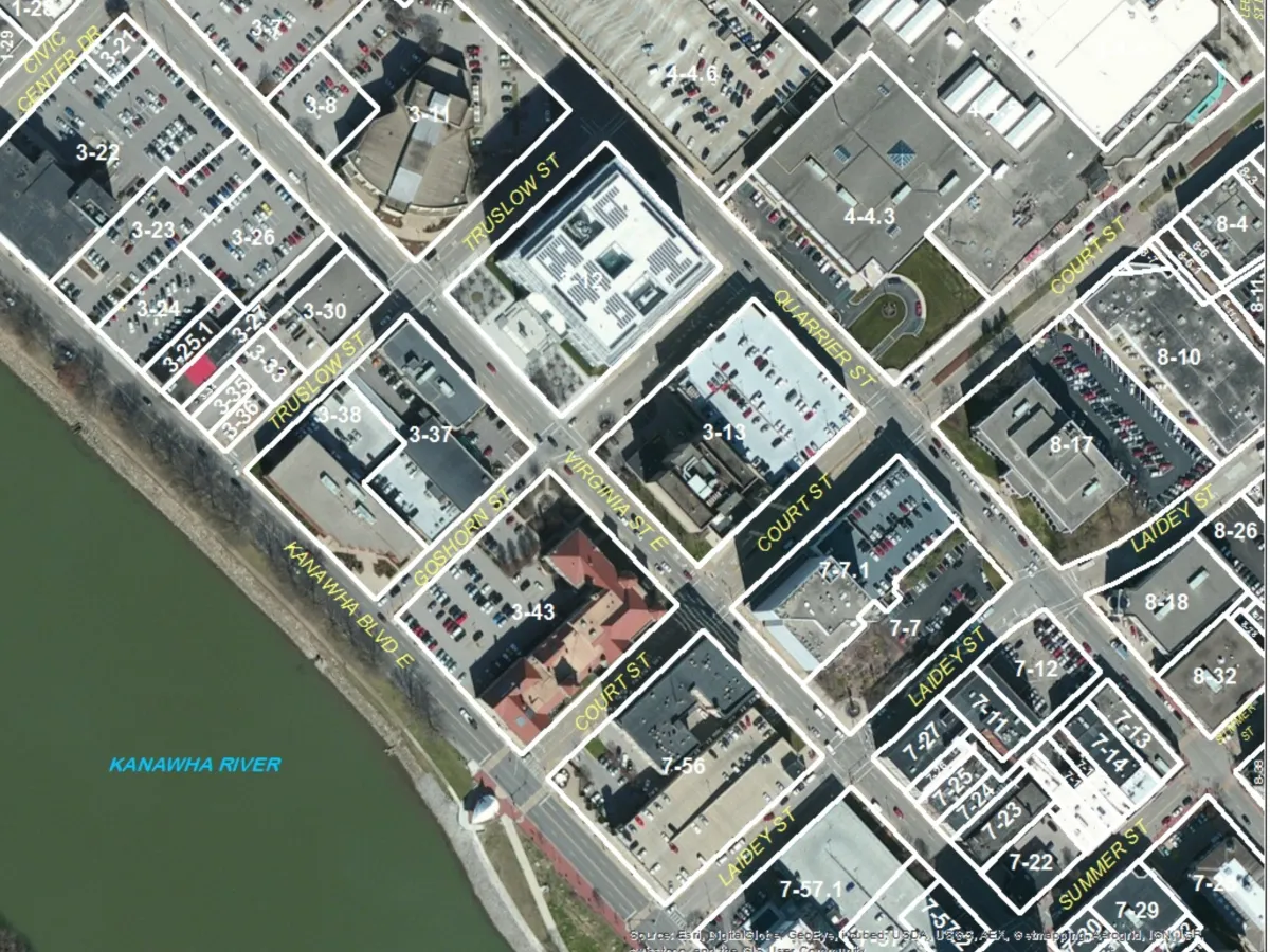
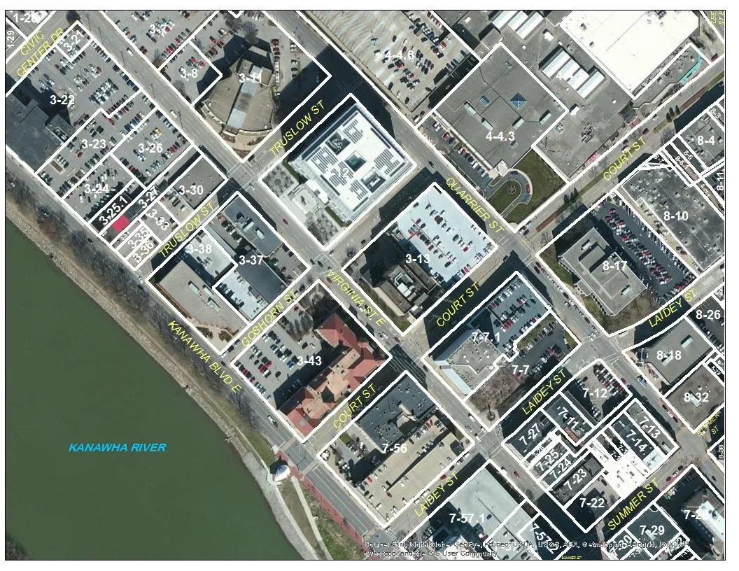
The purpose of the GIS department of the Kanawha County Assessor’s Office is to create and maintain digital and paper tax maps. We also maintain a database of all parcels taxed within the county’s boundaries. We are currently working to provide a more accurate paper representation of all tax parcels available to the public using digital mapping. This will allow tax parcels to be clearly and accurately depicted based upon public records. Our goal is to create a map that is appealing to the public as well as accurate based upon deeds, surveys, etc. This will not only help the taxpayer to be able to locate their property, but will also afford our appraisal department the ability to fairly and accurately evaluate properties.
It is also the goal of our department to be public friendly. We enjoy working very closely with surveyors, property appraisers and the citizens of our county. We encourage all taxpayers to inform us of any errors found while reviewing the tax maps.
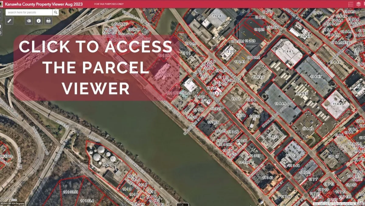
ESRI Tax Maps
Tax Map Disclaimer:
Please read the following information before continuing.
The Kanawha County Parcel Viewer is provided by the Kanawha County Assessor’s Office to allow for easy access and a visual display of County information. Every reasonable effort has been made to ensure the accuracy of the maps and data provided; nevertheless, some information may not be accurate. The Kanawha County Assessor assumes no responsibility arising from the use of this information.
THE MAPS AND ASSOCIATED DATA ARE PROVIDED WITHOUT WARRANTY OF ANY KIND, either expressed or implied, including but not limited to, the implied warranties of merchantability and fitness for a particular purpose. Do not make any business decisions based on data before validating your decision with the appropriate County office.
The Assessor parcel maps are for assessment use only and DO NOT represent a survey.
The Assessor parcel maps are compiled from official records, including surveys and deeds, but only contain the information required for assessment.
Please contact us with your comments or suggestions. If you find any errors in our information, please notify us (304)-357-0222. Assessor’s maps and data are constantly being updated. The issue will be researched and corrected where appropriate. Your feedback is important in determining the type and demand for services needed by the public.
For the most current information contact the Kanawha County Assessor’s office at (304)-357-0222.
YOU ACKNOWLEDGE THAT YOU HAVE READ THE ABOVE CONDITIONS BY USING THE LINK BELOW TO ACCESS THE MAPPING INFORMATION
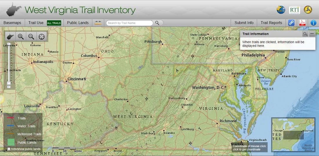
West Virginia Trails
WV Flood Tool
The West Virginia Flood Tool is designed to provide floodplain managers, insurance agents, developers, real estate agents, local planners and citizens with an effective means by which to make informed decisions about the degree of flood risk for a specific area or property